Field research
Crikvenica (Ad Turres) – “Igralište” site: Sextus Metilius Maximus’ pottery workshop
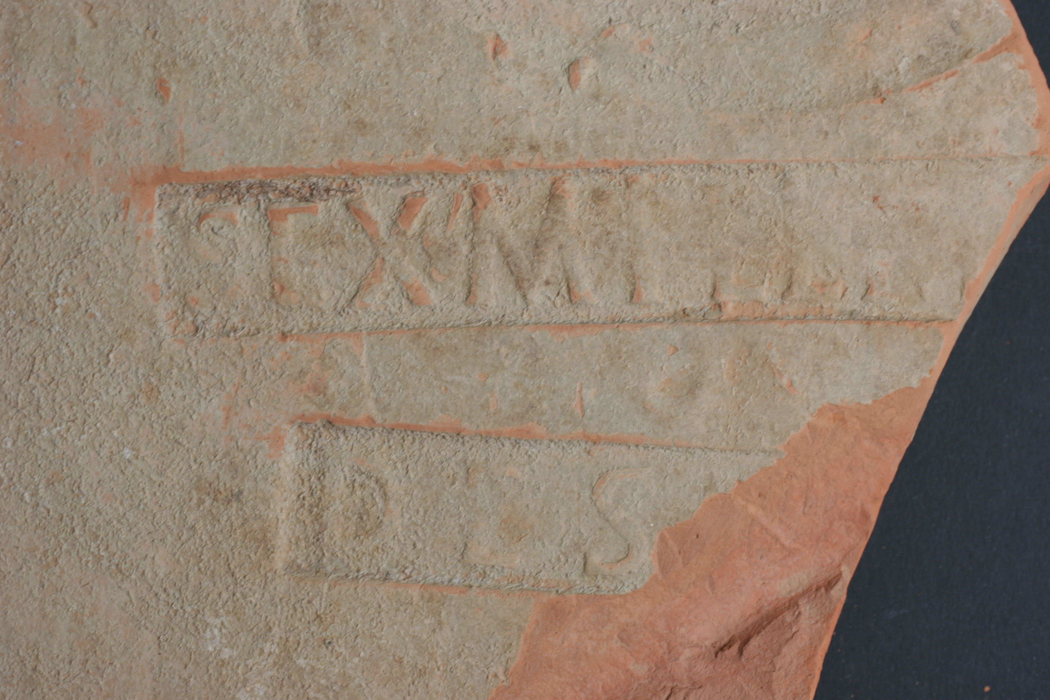
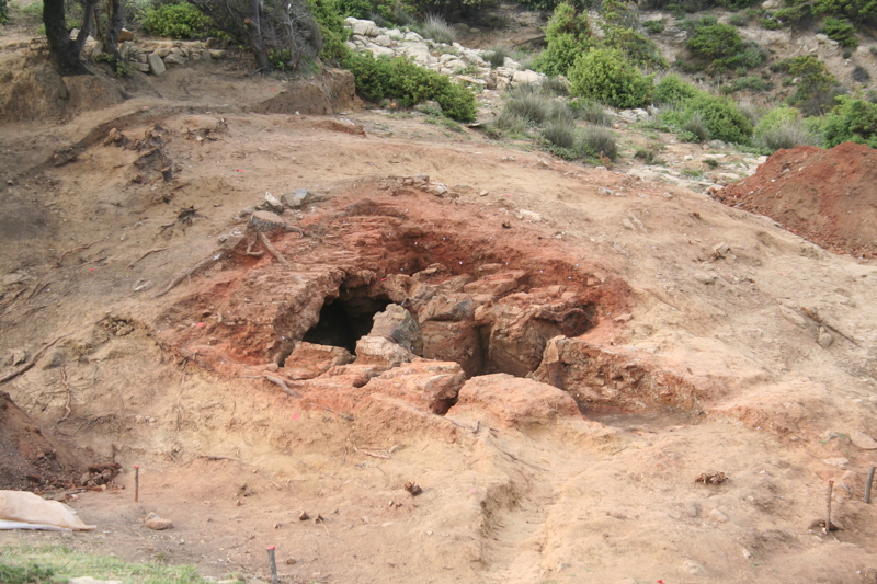
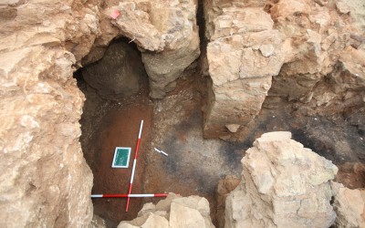
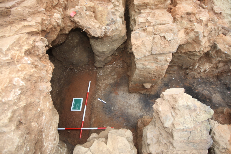
The site Crikvenica Ad Turres – Igralište has been systematically investigated since 2006, when the remains of a pottery workshop have been identified. Its owner, Sextus Metilius Maximus, is know from tile stamps. The road station Ad Turres know from the sources probably coincides with the wider area of Crikvenica’s bay and its hinterland, where, in all probability, the land property of Sextus, his saltus, within which the figlina operated, could have been located.
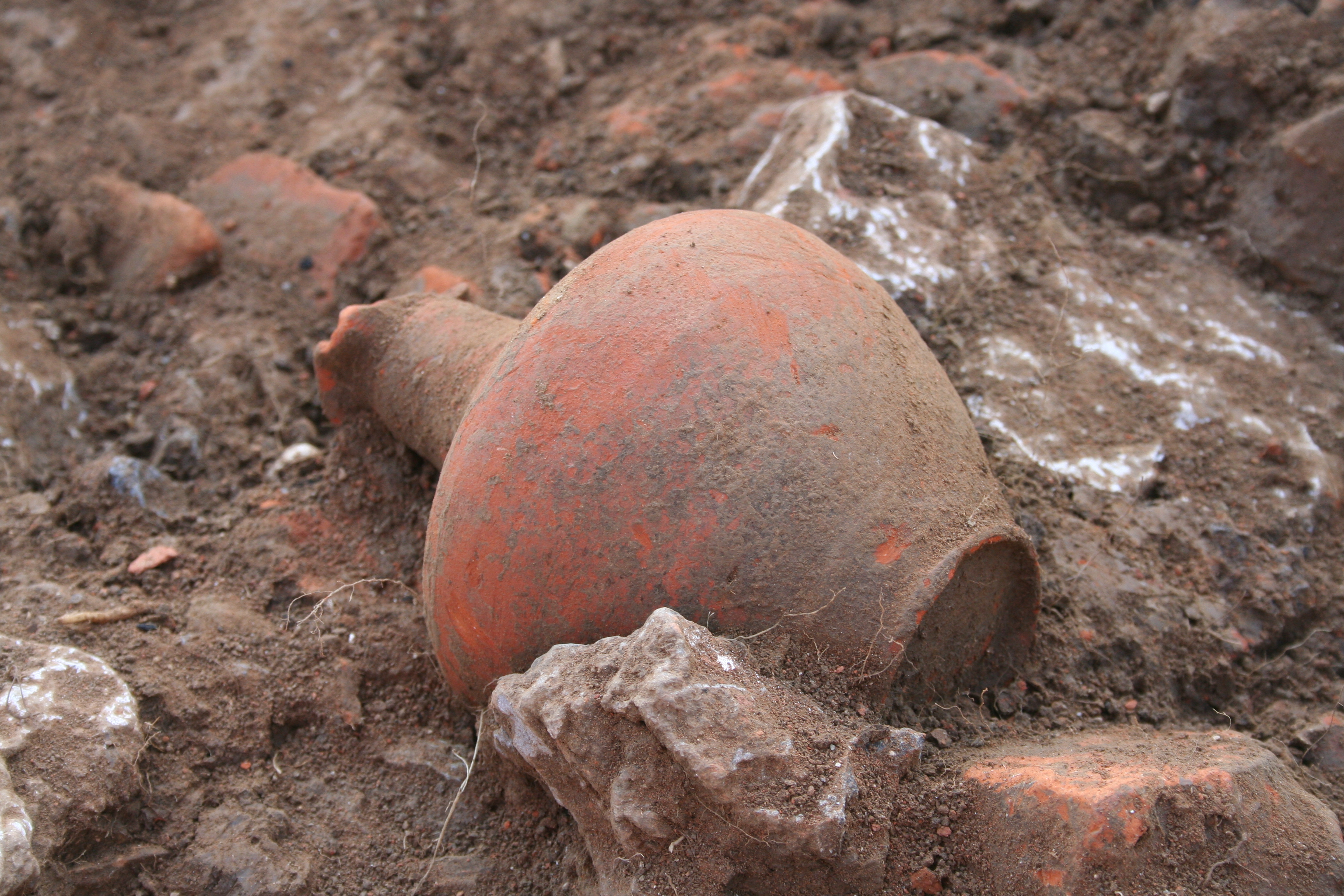
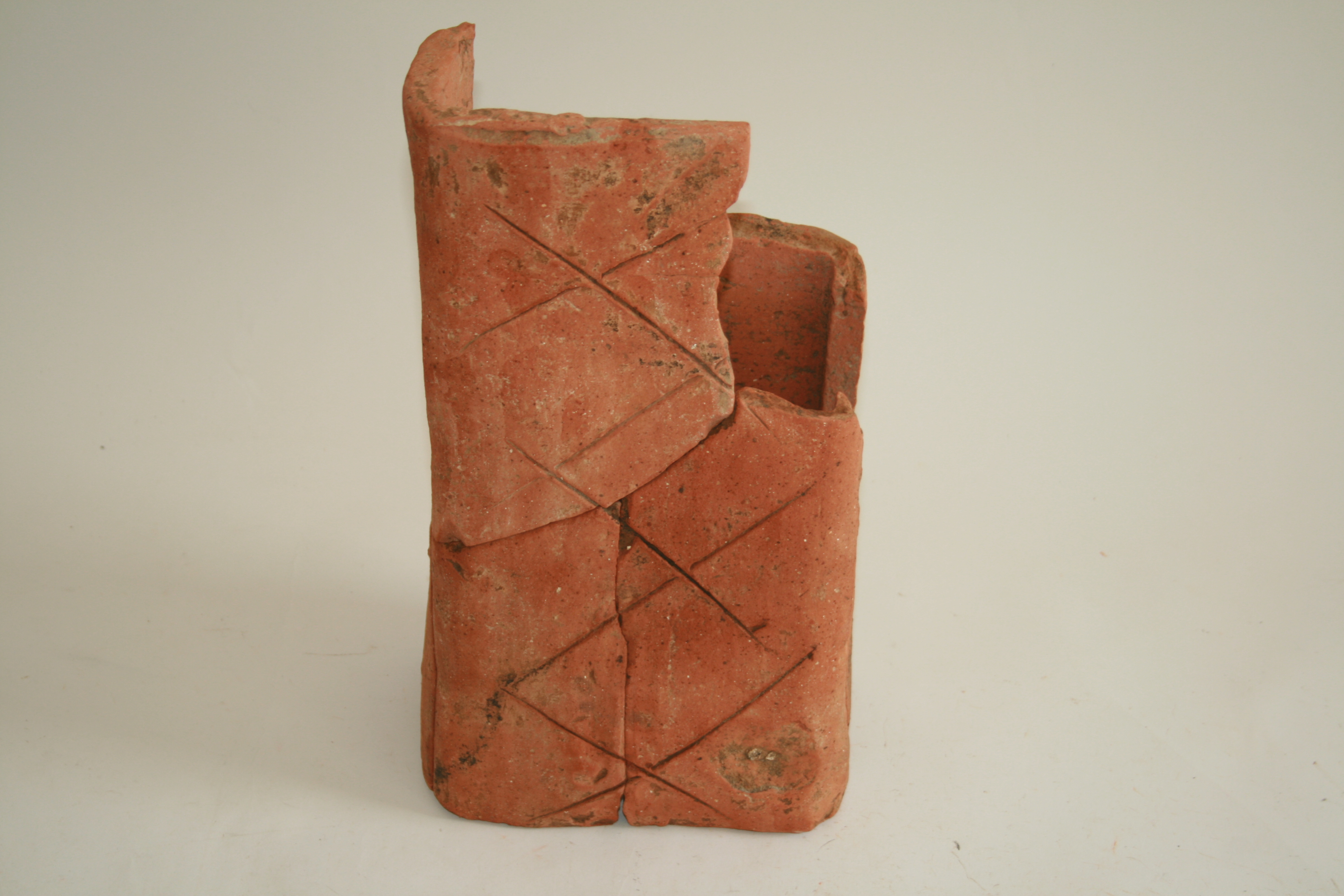
On an area of 1800 m2 four pottery kilns, various workshop spaces and its infrastructure have been excavated, while the original extension of the workshop is supposed on an area of 6000 m2, with probably also annexed some docking infrastructure. Along with field research, finds’ processing is being carried out as well, mostly comprising pottery and ceramics’ wasters. Since the wasters amount to several dozen tonnes, processing the material is a key segment of the research, being a starting point for a doctoral dissertation and several papers. In fact, within the waste materials a series of shapes specific for this workshop has been identified, including amphorae and ceramic building materials and common ware, with loom weight being also a specificity.
At the same time, Crikvenica’s production is, as the only so far confirmed pottery production centre of the province Dalmatia, one of the starting points of the project RED, within which its wider significance for the 1st-2nd c. economy of the eastern Adriatic is being perceived through analysis of its products’ distribution, the relationship with imported wares, as well as with the definition of its technological particularities (raw materials, firing technology etc.). For the needs of these analysis a data base has been created (FileMaker) which will allow the collection and analysis of a large amount of data: from the morphological characteristics of Crikvenica’s types to archaeometric analysis of its fabrics.
-
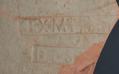
- Tegula with Sextus Metilius Maximus’ stamp
-
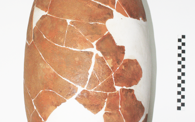
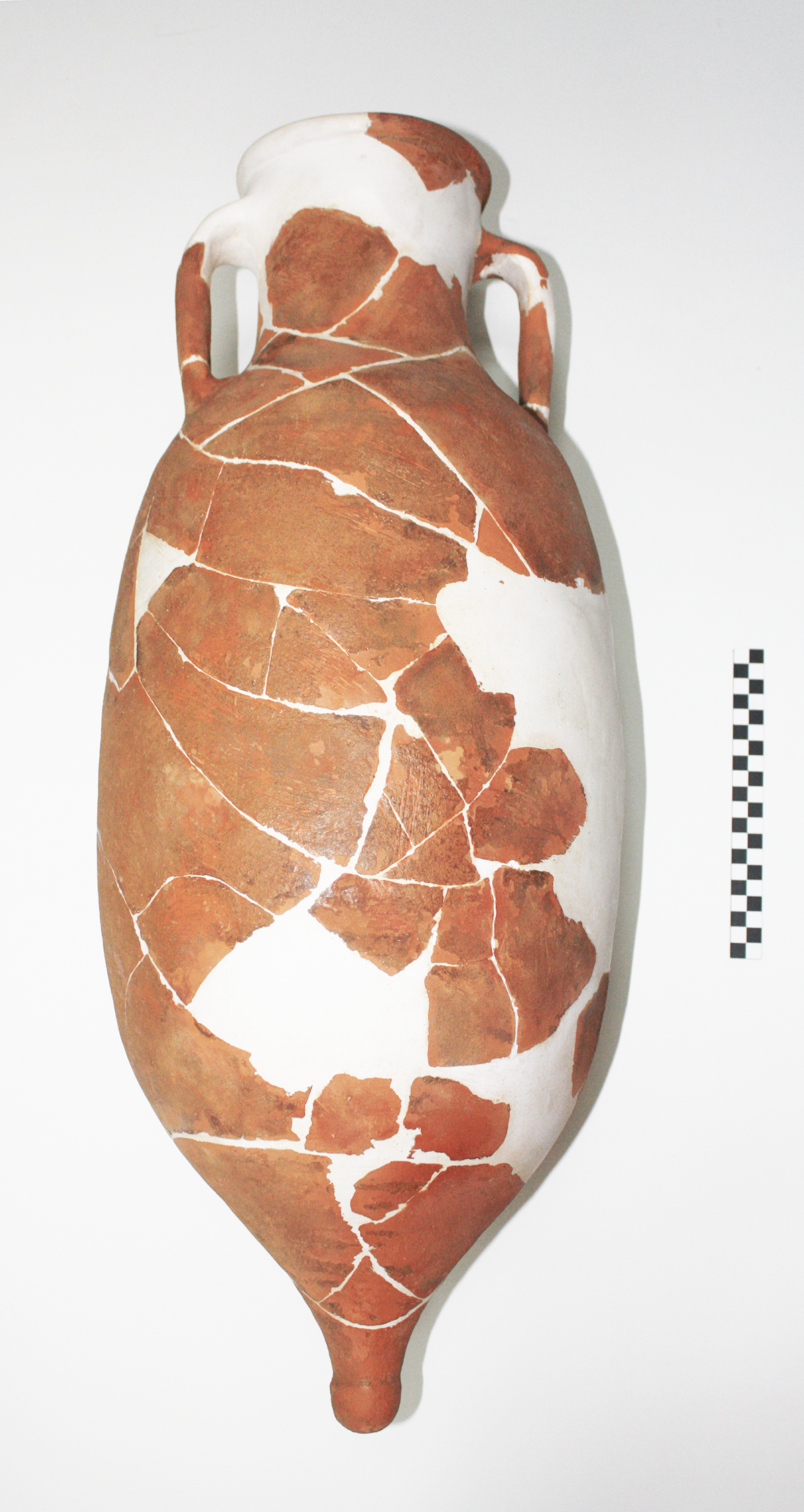
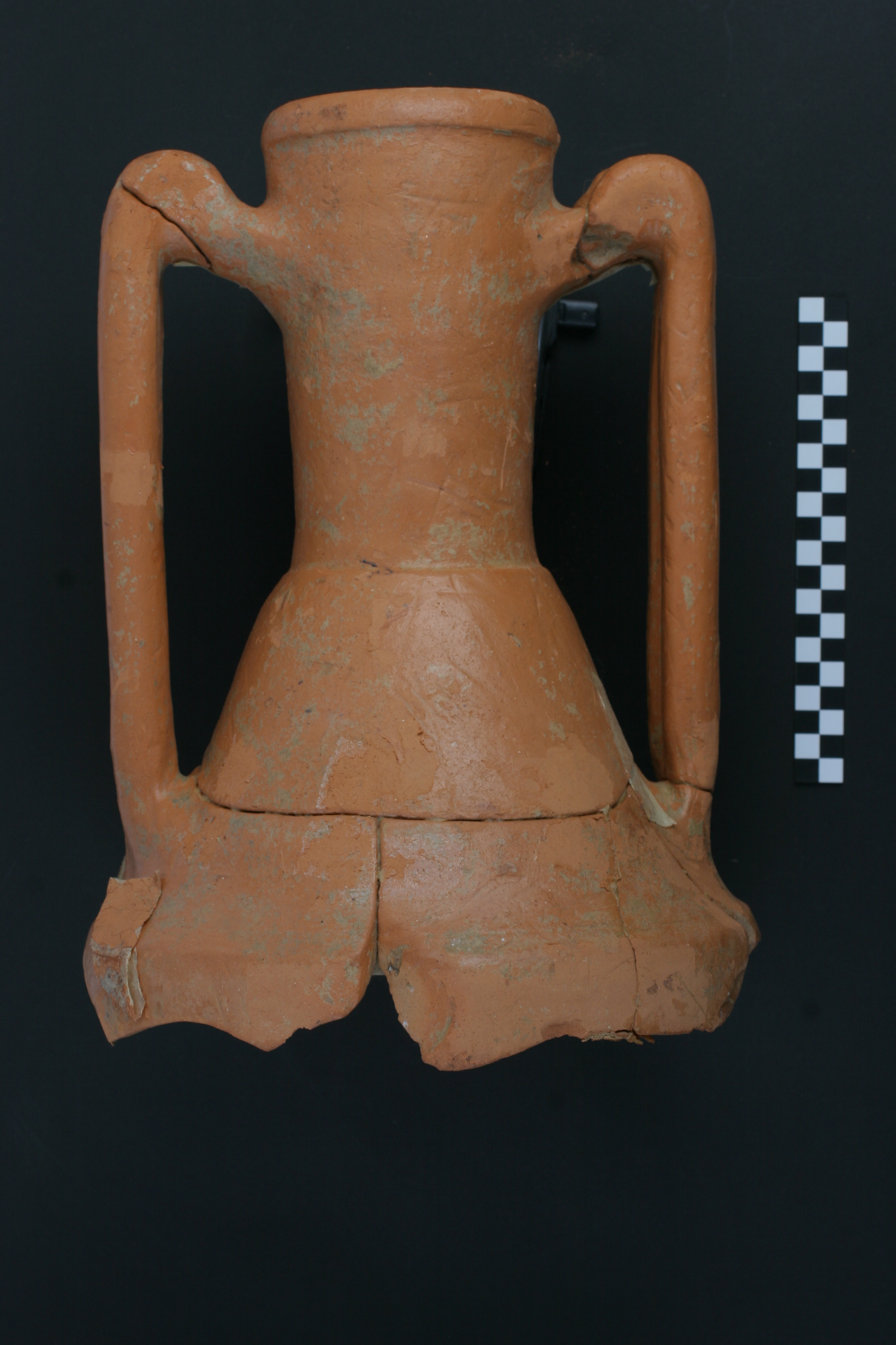
- A complete jug found during excavations at Crikvenica
-
- A complete jug found during excavations at Crikvenica
-
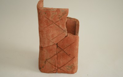
- Tubuli of Crikvenica production
-
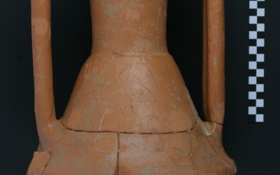
- Crikvenica’s Dressel 2-4 amphorae
-
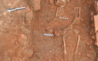
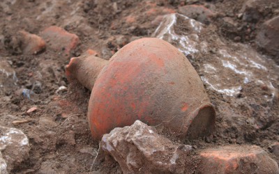
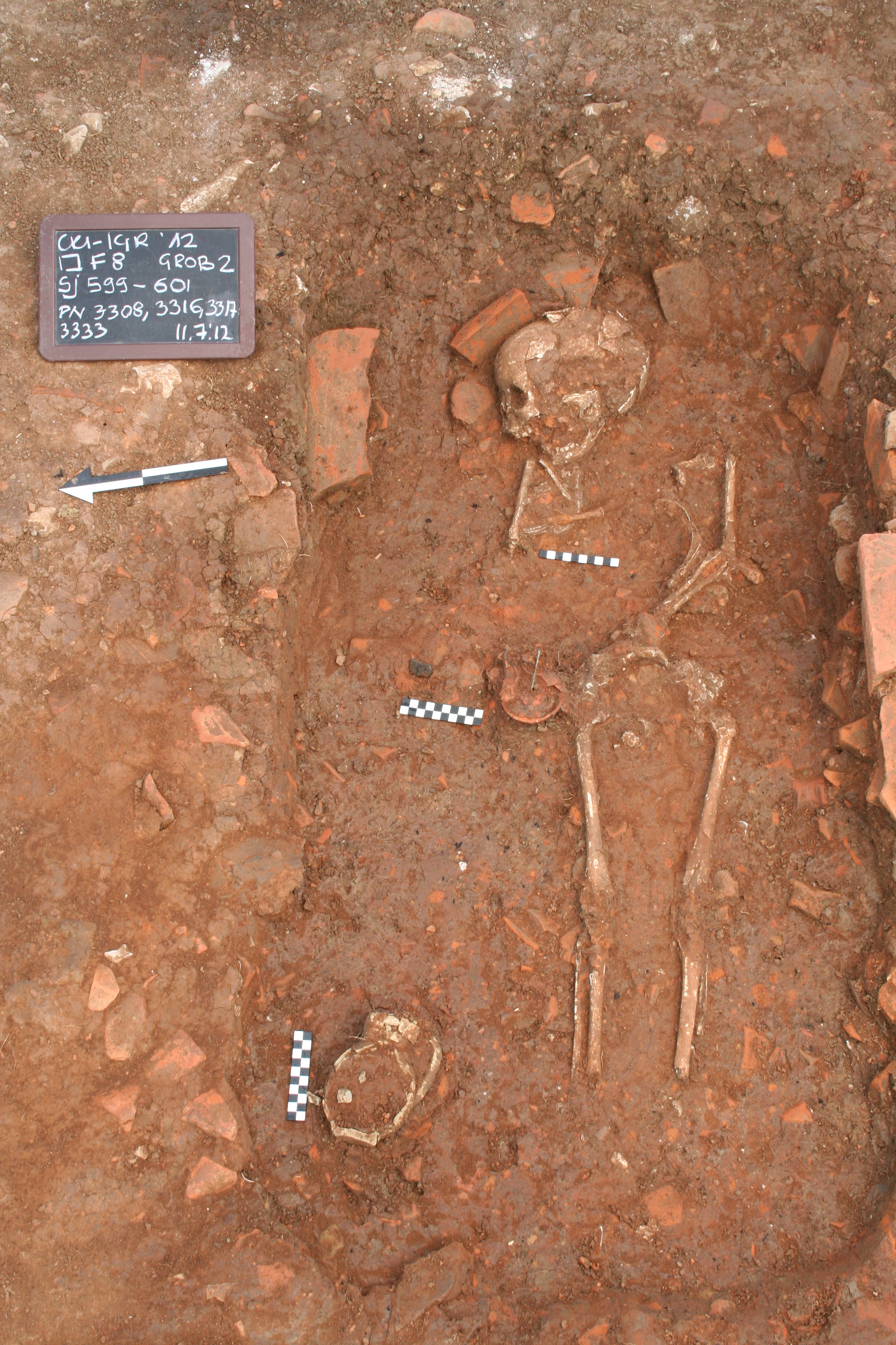
- A grave found at the site Igralište
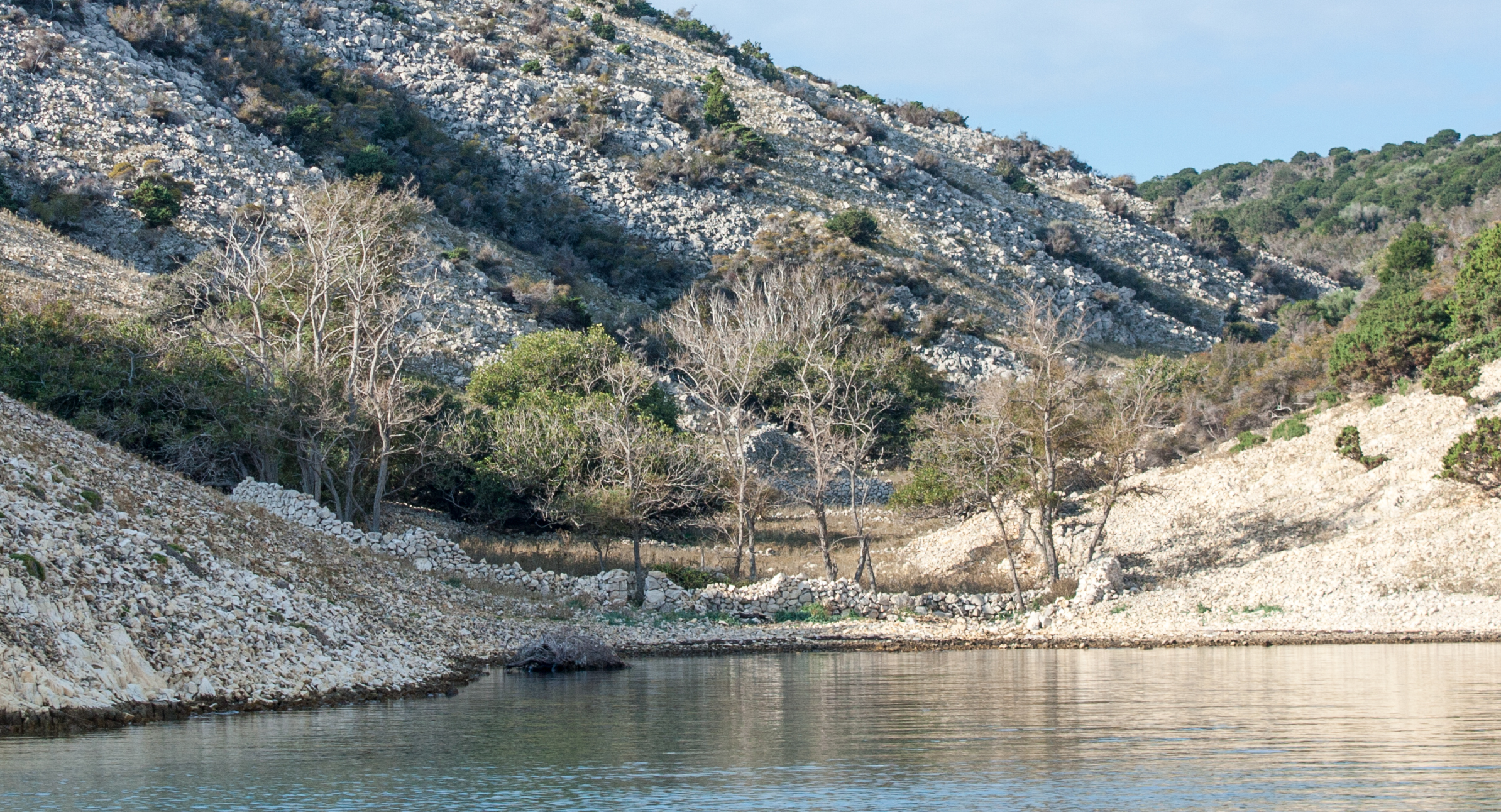
Lopar (Rab island) – Podšilo and Mahućina bays
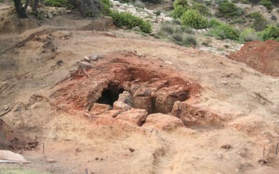
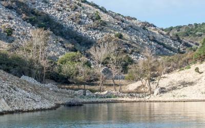
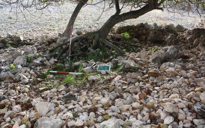
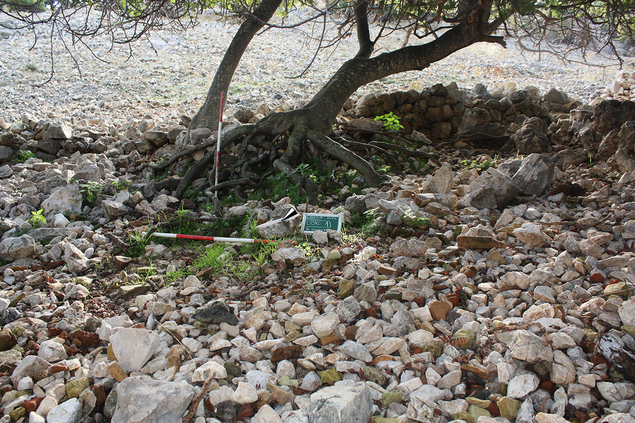
On several location In the area of Lopar pottery production has been supposed or definitely established. The first indications of pottery production have been gathered during field survey in Podšilo bay in 2005, while after excavations in 2009 the existence of one pottery kiln has been confirmed, while other have been supposed. Due to strong erosion that characterises this area the remains of production features have mostly disappeared, but the excavated kiln can be connected to a larger rural production complex, with all probability active during the 3rd c. and producing ceramic building materials. After several filed walking campaigns the core of the complex can be supposed at the Beli Grad or Podkućine sites, located to the north and to the west of the bay’s shore.
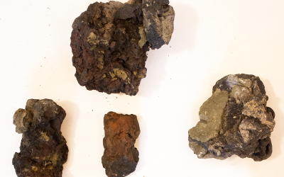
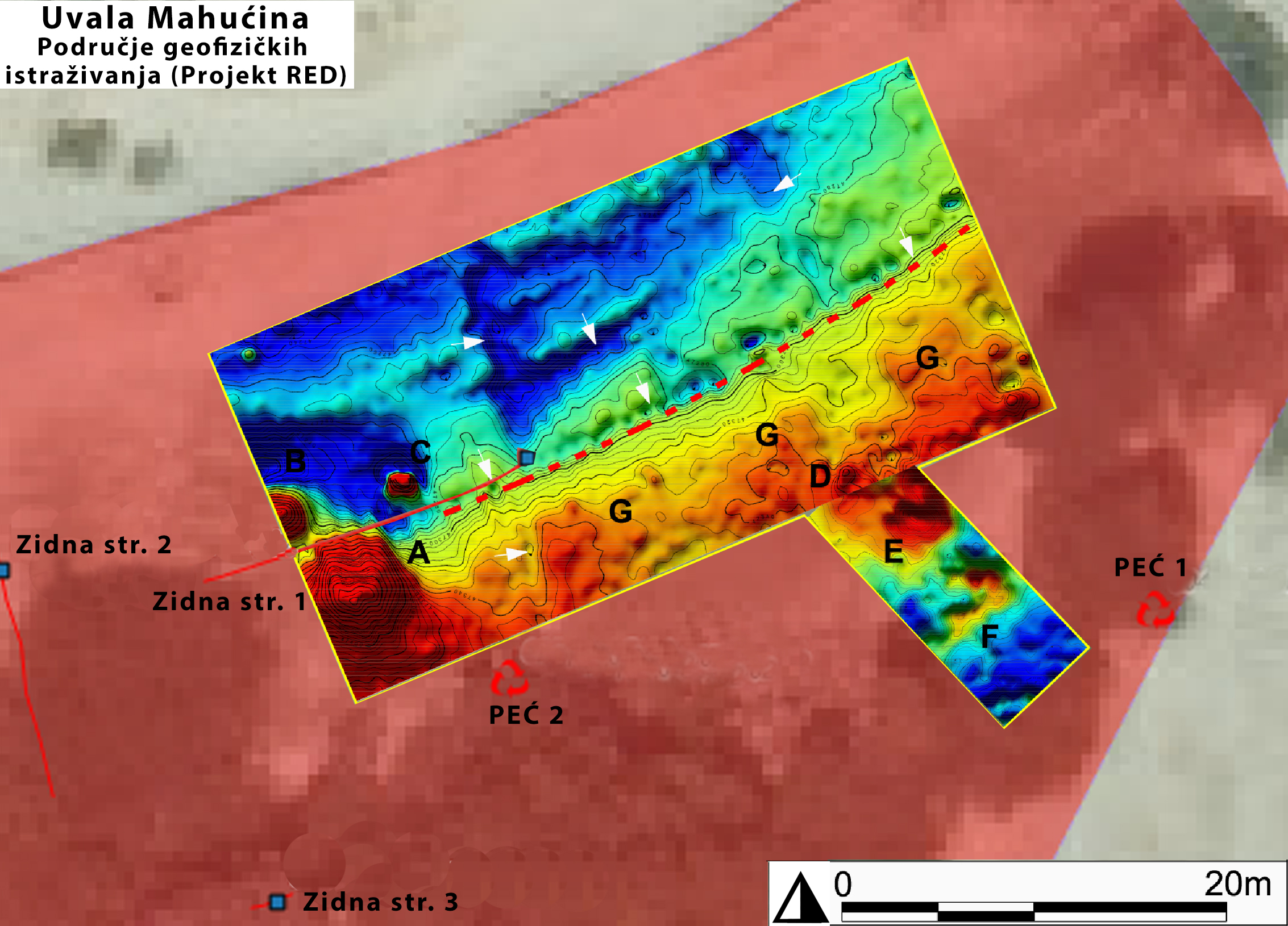
The second production zone located at Lopar is that within Mahućina bay, in the north-eastern part of Sorinj peninsula, in front of Lopar’s harbour. Here, large amounts of pottery waste have been established (overfired fragments of ceramic building materials, fragments of kiln’s structure, fired soil) stretching over an area on the south-eastern slope and in the bay’s hinterland. Possible kilns’ locations have been established during field survey after which geophysics measurements were carried out. These allowed to confirm the location of at least one kiln, whose structure is in all probably severely damaged. It is, for now, impossible to confirm the existence of other workshop structures, although in the bay’s hinterland possible clay sources are present.
The role of Lopar’s kiln within the economy of northern Liburnia, but also province Dalmatia, is yet to be established through their products’ analysis (the definition of types, raw materials and technological characteristics), their location within archaeological and geological topography of the peninsula, which is one of the goals of the project.
More on the reaserch activities on the Island of Rab and their results:
– Uvala Mahućina
– Uvala Podšilo
-
- Excavated kiln at Podšilo bay
-
- Details indicative of kiln remodelling
-
- Mahućina bay
-
- Kilns’ location at Mahićina bay
-
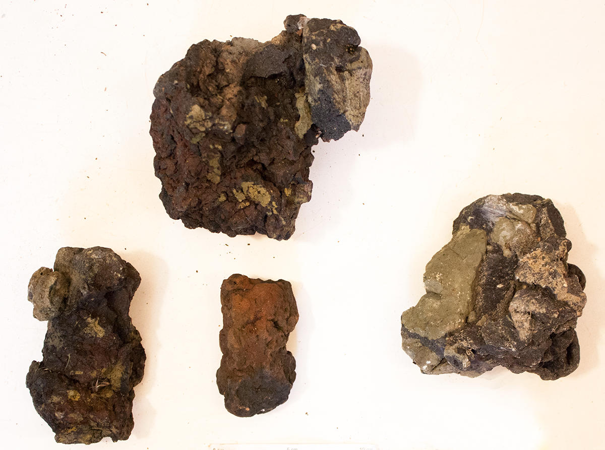
- Overfired fragments of the kilns’ structure from Mahućina bay
-
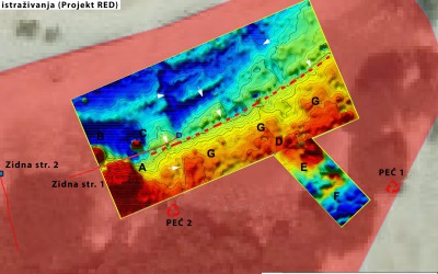
- Results of geophysics measurements in Mahućina bay
Ražanac, Rtina – Plemići bay
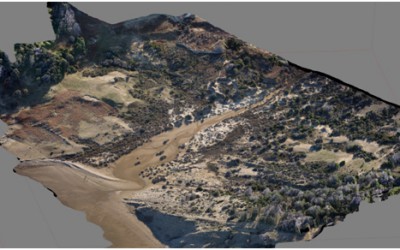
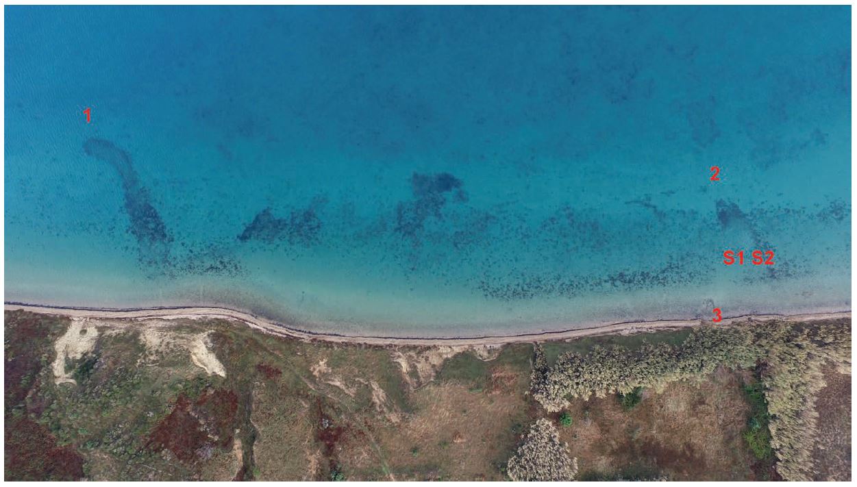
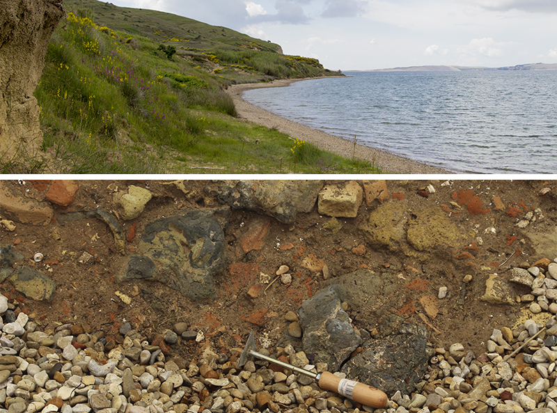
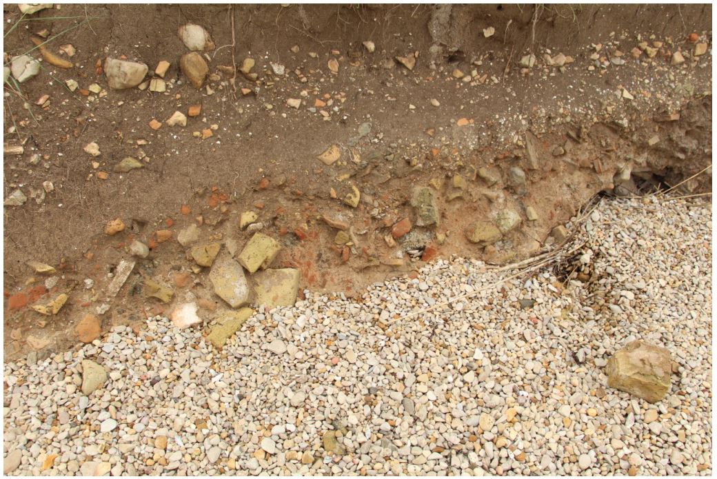
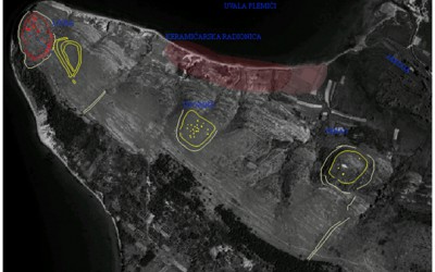
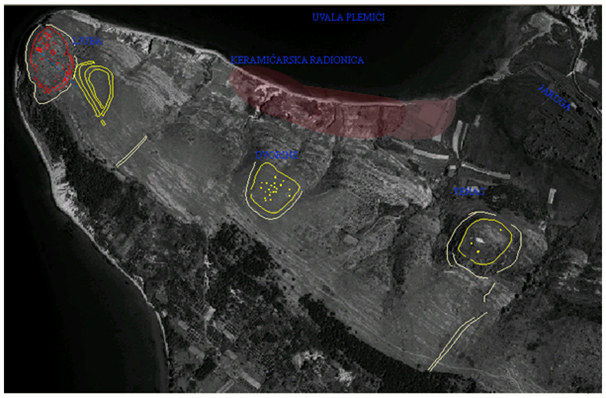
Plemići bay, located between the settlement Rtina and Ljubačka kosa, has been included within project RED due to finds of large quantities of pottery wasters and layers of overfired soil, charcoal and ash which characterise the high profiles located right above the beach. This chance finds has been brought to light by the cooperation of the University of Zadar and the local community, after which terrestrial and underwater field surveys have been carried out. Thanks to the preliminary results of these research activities, carried out by Z. Brusić, M. Ilkić and M. Parica from the Departmentof Archaeology (University of Zadar), it is possible to suppose that the wider area of the bay and its hinterland are occupied by the remains of a roman rural complex within which pottery production took place. Pottery, and possible other goods produced within the complex, was then distributed by sea to a wider area of northern Dalmatia. In fact, the underwater finds of tge remains of two peers indicate the existence of docking structures.
-
- Aerial view (Ilkić, Parica 2017: sl. 7)
-
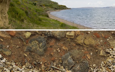
- Plemići bay
-
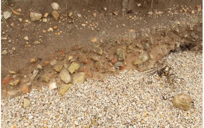
- Layers of wasters
-
- Wider area of the bay
Within the activities of project RED archaeometric definition of the raw material and products of the workshop in Plemići bay is being carried out. To our current understanding within this workshop amphorae and tegulae were produced, but other products cannot be excluded. Two tile stamps discovered within the pottery waste and other finds indicate two phases of production – two different owners or two different organisation models – whose chronological characteristics are yet to be defined.
Moreover, on the basis of aerial and satellite images, the wider area of the bay has been analysed in order to better understand the location of this complex within its natural setting.
Future activities include geophysics measurements on selected areas of the bay.
More on the reaserch activities in Plemići bay:
– Terenski radovi u uvali Plemići